Guide With Hiking Routes Through The Jerte Valley
This beautiful natural region of Extremadura has been declared of Cultural Interest. In this article we show you some of the best hiking trails in the Jerte Valley. You are going to enjoy wonderful landscapes. Can you come with us?
The relief of the Jerte Valley
Before talking about the hiking routes through the Jerte Valley, it would be good for you to know what the relief that you will find during your journey is like. First of all, you should know that the region is between two mountain ranges : the Sierra de Tormantos, to the southeast, and the Montes de Traslasierra, to the northwest.
The rocks are mostly granite and are about 300 million years old. The network of rivers is commanded by the Jerte, which runs for about 70 kilometers until it flows into the Alagón river (a tributary of the Tagus).
The climate in the Jerte Valley is of the continental type and temperatures range from 3 ° to 10 ° C in the lowest areas to 30 ° C in the most southern.
Hiking routes through the Jerte Valley
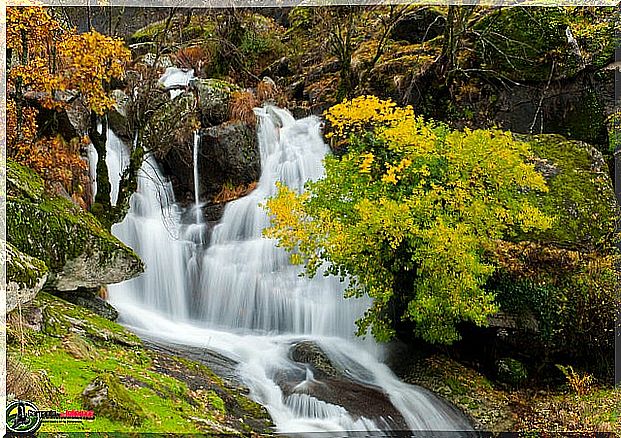
Green landscapes, mountains, waterfalls and a lot of peace … all that and more is what you will find in this beautiful place. And it is that in the Valle del Jerte you can enjoy almost 20 routes marked and prepared for hiking.
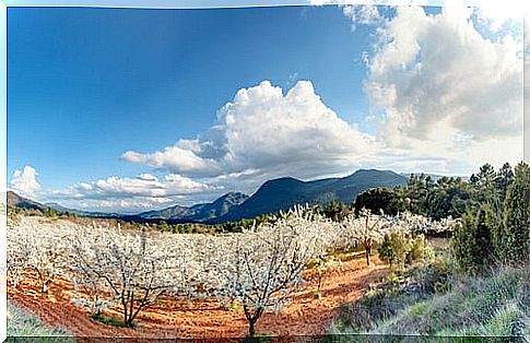
Although there are many perfect times to tour the area, there are athletes who decide to do it in early spring. The flowering of the thousands of cherry trees that flood the valley give it a spectacular image. An event that is celebrated in style with a lively party.
Now we are going to discover some of the most beautiful routes for hiking in the Jerte Valley. You can choose the one you want according to your physical condition. Or do several, if you have time.
1. The Umbria
This route is 13.5 km long and begins at the place where you must leave the car to access the Garganta de los Infierno (between Jerte and Cabezuela del Valle).
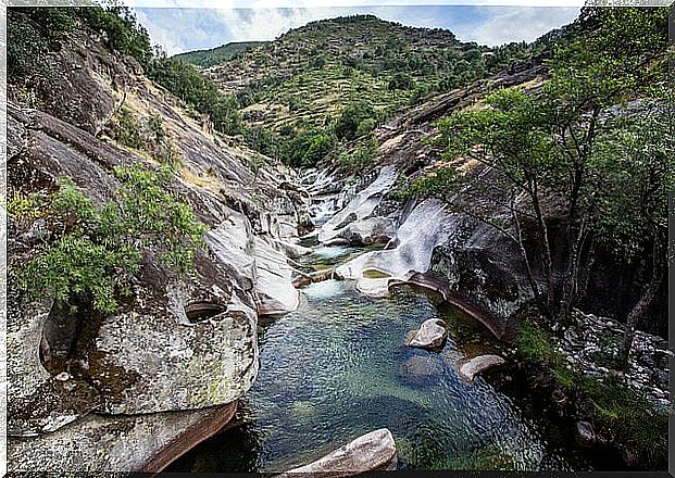
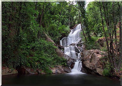
The first thing you will see will be the ruins of Vadillo. After crossing the town, the next stop is the hermitage, with its beautiful views of the valley. The ascent begins to a viewpoint, before entering the Garganta de los Infierno Natural Reserve, with its forest full of waterfalls, bridges and trails.
When you reach Los Pilones, cross the river between rocks (some take the opportunity to take a dip) and arrive at Chorrero de la Virgen. Go down to the interpretation center and end in the same place where you started.
2. Hells Throat
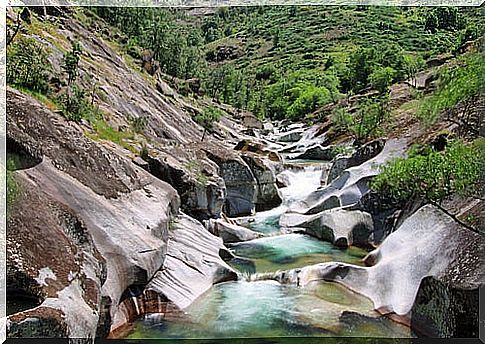
This hiking route through the Jerte valley begins at the interpretation center and goes through an oak grove. The path is uphill until it reaches a cobbled track in the Los Pilones area, where the river is encased by large rocks and which is ideal for swimming.
To the right there is a detour called Puente Nuevo, follow that way to the Garganta de las Yeguas and then to Puente Carrascal, which you must cross. You will find another climb until a sign indicates the direction to Candeleda (17.5 km) along the Carlos V route, from Tornavacas. This is the trip that King Carlos I of Spain made to the Yuste Monastery.
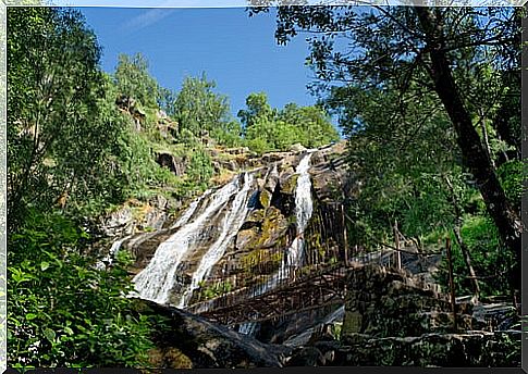
Leave the sources of Zarzalones and Robledo Hermoso behind and observe the views of the Garganta de los Infierno (Hell’s Throat) and then retrace the path.
3. Circular route of the Throat of Hell
Go to the Plaza de Independencia de Jerte. Go down Calle Hornacina and cross the river on the Puente Largo. Turn right onto a somewhat steep concrete track between cherry orchards. There are some informative posters with distances to the main points of the route.
Walk 1.5 km to the Monte Reboldo chestnut grove. Then continue for 3 km and take the path that takes you to Collado de las Losas. The route coincides with that of Emperor Charles I for 3 km to the New Bridge, after passing the Garganta de los Infierno. Continue along the river bank and go down to Los Pilones.
It reaches the Fuente de Robledo Hermoso, then ascends to Collado de las Yeguas, passes through the shepherds’ hut and the source of the Zarzalones. Shortly after, you will arrive at the Carrascal bridge and after a section uphill you will be in Charco Bonito (or de la Reata).
Where the gorges meet comes to Los Pilones. Cross the wooden bridge and continue to the right to the Chorrero de la Virgen viewpoint. Take the track towards the chestnut grove and after 3.5 km you will be back in Jerte.