Hornopirén National Park: Discover A Paradisiacal Site
Hornopirén, ‘snow oven’ in Mapudungún, is a volcano that is located in the south of Chile, specifically, in the commune of Hualaihuré, in the Los Lagos Region. This volcano gives its name to the Hornopirén National Park, which is included in the Biosphere Reserve of the Temperate Rainforests of the Southern Andes.
We are going to delve into the characteristics of this park. We will also explain the possibilities that exist of being able to visit it and develop outdoor activities in that paradisiacal natural environment.
Characteristics of the Hornopirén National Park
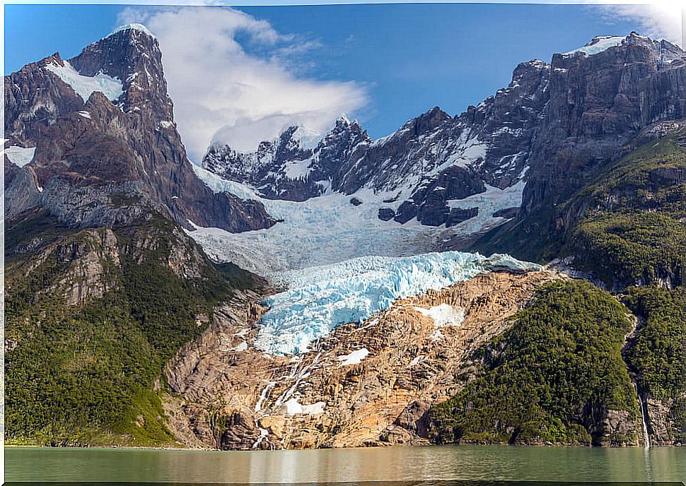
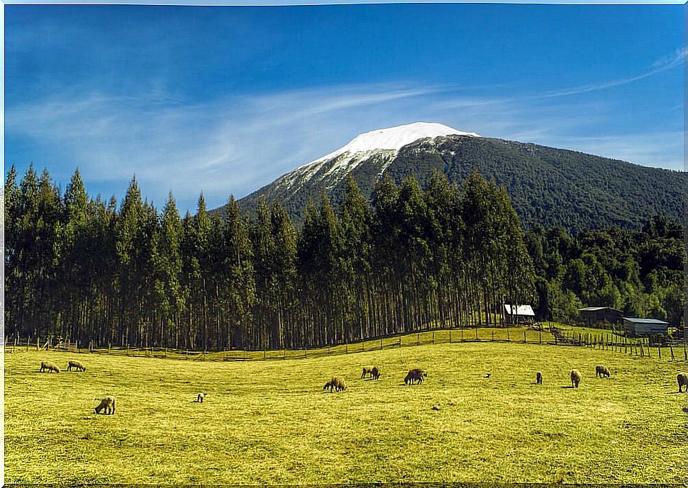
In 1988, with Decree number 884, the Hornopirén National Park was created. Its extension is 48,232 hectares. Given its location in the Andes mountain range, its geography is characterized by mountains and valleys shaped by snowdrifts, volcanic activity and the action of glaciers.
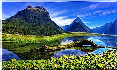
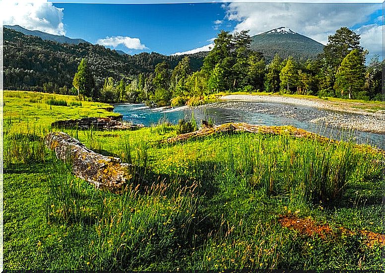
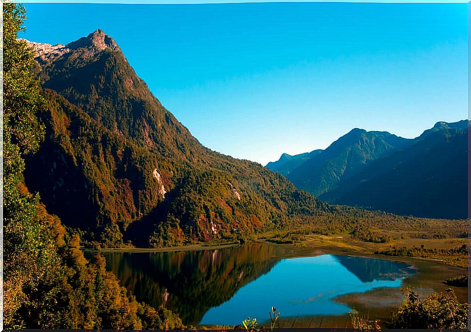
The landscape of the park is crowned by the Hornopirén volcano which, although it gives the park its name, is located outside its limits. Between the valleys we find various lakes and lagoons. The three main ones are the Cabro, Inexplored Lakes and Pinto Concha.
In turn, different rivers descend rapidly from the heights of the Andes, slowly sculpting the valleys of the park. Some of these rivers are Puelo Chico, Ventisquero and Blanco. The latter, which flows into the Comau fjord, has a waterfall that is an essential visit.
More than half of the park is covered by vegetation. For this reason, as we anticipated, it is part of the World Biosphere Reserve of the Temperate Rainforests of the Southern Andes. Among the plant species that we will be able to appreciate are the larches, coigües de Magallanes, mañíos, lumas, tepús and lengas in the highlands.
The fauna of the park is also very rich and varied. There are about 25 species of mammals. The puma, the wink, the quique, the fox, the pudu and the coypu are some of them. On the other hand, 123 species of birds are registered, such as the chucao, hued hued, colilarga, black woodpecker, kingfisher and flying quetru.
Visit the Hornopirén National Park
Get to the park
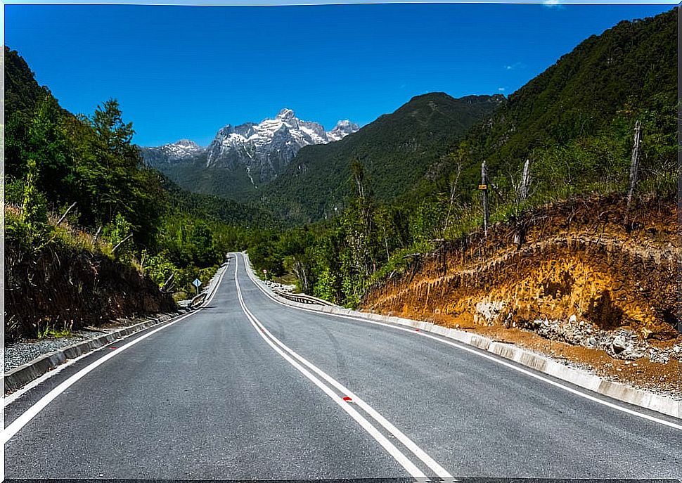
To get to the park, we must first go to the town of Hornopirén. You can get there by car from Puerto Montt. To do this, you must take Route 7 towards Caleta La Arena. There you must take a ferry that will take you to Caleta Puelche. If riding a boat is not your thing, you can also get to Caleta Puelche from Cochamó and Puelo by the V-69 route.
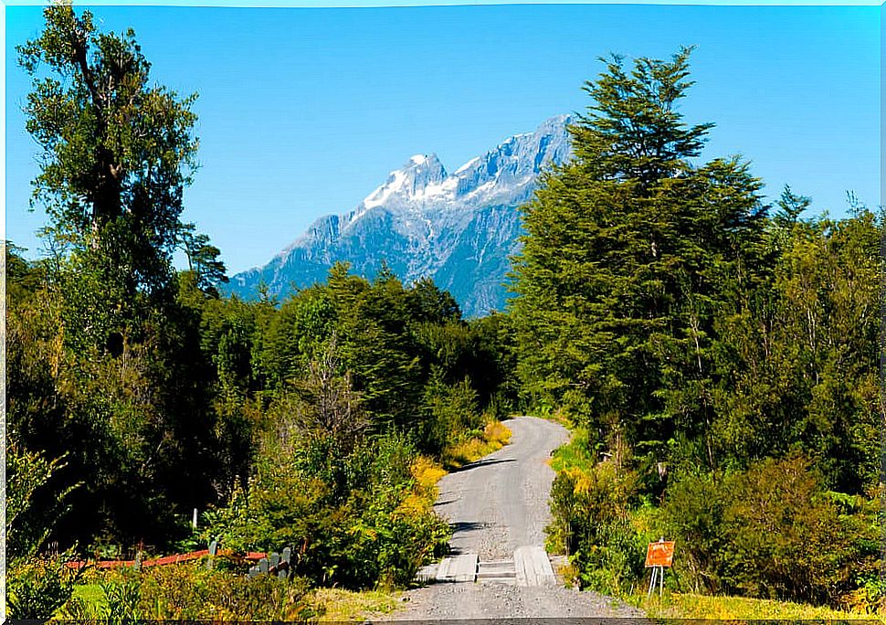
Once you have reached Caleta Puelche, you must continue heading south until you take the coastal route that begins in Contao. It goes 60 kilometers until it reaches Hornopirén, passing through towns such as La Poza and Aulén. Already in Hornopirén, from the Plaza de Armas you must go to the Chaqueigua Alto sector.
After ten kilometers you will find the registry house of the National Forestry Corporation (Conaf). There you will have to leave the car parked and walk seven kilometers until you reach the entrance of the park.
You can also get to Hornopirén by bus. From Puerto Montt, daily, a bus company makes the route to this town. Once in Hornopirén, from the north corner of the Plaza de Armas there are transport services that take you to the Conaf registry house. It is convenient to coordinate the return, since outside the town there is no telephone coverage.
What to visit in the park?
There are several routes, such as the one that reaches the southwestern edge of Lake Pinta Concha, at about 950 meters above sea level. It is a section of medium-high difficulty in which 14.3 kilometers are covered in total.
The duration of the tour is approximately eight hours. The starting point will be found at the sign that welcomes the park located seven kilometers from the Conaf registry house. It is a route that is only enabled between the months of October to March.
Another of the tours is the one that takes you to the slopes of the Yates volcano. The difficulty is also medium-high. The starting point is at Pinta Concha Lake. From there we will have to travel an ascending path for 3.6 kilometers to the volcano.
The total distance that we will walk is 7.2 kilometers and it will take approximately three and a half hours. As in the case of the previous route, the path is enabled only between the months of October to March.
Services within the park
Entering the Hornopirén park has no cost. In it there are several picnic and camping areas. One of them is in the extreme southwest of Lake General Pinto and the other in Lake Pinta Concha. This last camping area is rustic and, therefore, does not have any facilities.
At the entrance of the park there is an advisory area where information regarding the park and its operation is delivered. During the months of January and February, a Conaf office is set up southwest of the Pinta Concha lake to offer information to hikers.
Inside the park there are no establishments to buy food so it is convenient to bring food. It is also important to note that, at all times of the year, mud is constant on the trails that run through the park. Therefore, it is advisable to wear suitable footwear to be able to enjoy this heavenly place without destroying our feet.